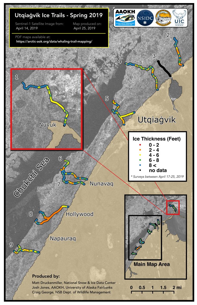
In mid-April, ELOKA scientist Matthew Druckenmiller visited Utqiaġvik, Alaska, to continue a 12-year mapping project of sea ice thickness along the community's annual network of ice trails, which are used for their spring bowhead whale hunt. As part of this project, which is now supported by the Alaska Arctic Observatory and Knowledge Hub (AAOKH), Druckenmiller and colleague Josh Jones of the AAOKH project traveled the ice trails by snowmachine, mapping locations with GPS, and measuring ice thickness with an electromagnetic (EM) conductivity meter mounted in a long plastic sled. Trail maps, such as this one from late April, are provided to the whalers and the local search and rescue office to inform the community on ice conditions and hunting crew trail locations.