

Maps

It’s critical to have all this knowledge written down so we can show it to those marine scientists. We need to show them that our people along the coast, we have to have our food from out in the ocean.1 Charles Seccheus, Sr.—Elim
The maps in this section describe:
- Areas used for hunting walrus, seals and whales, combined with important habitat areas for each species
- General areas for harvesting fish and shellfish for subsistence in marine and coastal waters
- General areas used for local small-scale commercial fisheries for halibut, herring, salmon and crab
- Important habitat areas for eiders
Although not all eiders are currently hunted to the extent they used to be due to population declines and restrictions, eiders were discussed in interviews with hunters and elders. As sea ducks, eiders seasonally occupy the same marine habitats as marine mammals. Spectacled eiders were emphasized because they winter in large aggregations in the ice between St. Lawrence Island and St. Matthew island, an area noted by elders and hunters as having particular ecological importance.
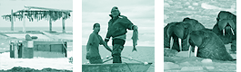
Mala Otton, Sheldon Nagaruk and Charlie Seccheus in an interview for Bering Sea Elders Group—Elim. Photo credit: Muriel Morse
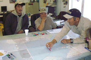
The use area maps contain data from interviews conducted with experts from 18 tribes and key local commercial fishermen for this project, as well as maps created by the two Coastal Resource Service Areas (Cenaliulriit CRSA in 2002 and Bering Straits CRSA in 1984). We did not conduct interviews in every village, but the CRSA data is inclusive of all villages. The three data sources differ from each other, but the aggregation of all the information shows a composite picture of general lifetime use of the people represented by the combination of all sources.
Elders noted that the ecosystem is naturally dynamic and also sensitive to disturbance; it is not possible to know what the future holds. Marine mammal movements may change, ice conditions may become increasingly more variable, harvesting needs may be different today than they will be in future years and so on. Elders and hunters emphasize that patterns of use must remain flexible.
Please see Appendix for a full description of methods.
Pacific Walrus
Subsistence Use
Important Habitat
All Seals
Subsistence Use
Bearded Seal
Important Habitat
Ribbon Seal
Important Habitat
Ringed Seal
Important Habitat
Spotted Seal
Important Habitat
All Whales
Subsistence Use
Bowhead Whale
Important Habitat
Beluga Whale
Important Habitat
All Eiders
Subsistence Use
Common Eider
Important Habitat
King Eider
Important Habitat
Spectacled Eider
Important Habitat
.png)

Shellfish
Subsistence and Commercial Use
