

About the Northern Bering Sea
We were taught about everything having to do with our land on the coast, the area around our village. They let us know about deep lakes and sloughs and taught us the names and channels down in the ocean. They also taught us spring hunting routes, places where ice formed. They taught us dangerous areas, and they let us know about areas we needed to avoid.
But even though they taught us, they told us that we will not learn the ocean. They said the ocean cannot be learned. They said it is not like land. They said the surface of the land doesn’t move and cannot float away or melt. They said on the contrary, the ocean freezes during the winter, and ice piles up in different places, and the ice melts during summer and goes. There is no set time in the spring when it breaks up and no certain date. That is why they said the ocean does not tell us what it is going to do….1 Frank Andrew, Sr.—Kwigillingok
How the ice comes in the fall, how thick it is, the location of open water leads, and how it goes out in the spring—these are some of the conditions that determine where the animals are and whether it is safe for hunting. The St. Lawrence Island Yupik language has 99 words for sea ice,2 and 70 words for ice have been documented in the Central Yup’ik language3 – precision in understanding ice conditions is a matter of survival.
The Bering Sea is the transition between the Pacific Ocean and the Arctic Ocean. Atmospheric and oceanographic conditions from both the south and the north influence temperature, wind, and the timing of the annual formation and retreat of sea ice in the northern Bering Sea. Seasonal sea ice is physical habitat for species that use it as a surface for resting and from which to stage foraging trips to the seafloor. It also plays an essential role in the generation of primary production (plankton), the foundation for the entire food web. Ocean conditions are dynamic, with high year-to-year variability, and the platform for marine mammals and birds formed by seasonal sea ice is continually in motion.
Researchers measuring conditions in the Bering Sea reported an increase in water temperature and a reduction in sea ice in the southeast Bering Sea between 1977 and 2005. Leading oceanographers reported, “There is a preponderance of evidence that the ecosystem of the Bering Sea is shifting in response to a northward retreat of cold ocean temperatures.”4 They noted that a cold water mass—the cold pool—that extends into the southeast Bering Sea from the north had retreated during later years of that period. Timing of sea ice formation was delayed and spring melting was earlier. Biologists found that 45 fish species had shifted the center of their distribution northward.5 Following this decades-long warming period, colder temperatures returned in 2006, sea ice extended far to the south, covering much of the eastern Bering Sea shelf, and southern Bering Sea fish species retreated.6
Despite the persistent loss of summer sea ice in the adjacent waters of the high Arctic, the same oceanographers surmise that winter sea ice in the northern Bering Sea will continue to form. The northern Bering Sea (north of 60° N) will remain cold enough in the winter and early spring to produce ice and the cold pool will persist in the north. Ocean temperatures and ice conditions will continue to vary greatly year to year in unpredictable ways, but the average temperature over time is expected to be warming.7
While the southeast Bering Sea is known for its large populations of fish, the northern Bering Sea ecosystem is dominated by dense aggregations of invertebrates living in and on the seafloor. Scientists have measured a high abundance of long-lived clams, amphipods and worms—a diversity of species forming a living seafloor—that is food for gray whales, bearded seals, walruses and eiders. The relative dominance among bottom species between St. Matthew Island and St. Lawrence Island is not the same as between St. Lawrence Island and Bering Strait, and these animals are unevenly distributed on the broad continental shelf.8 How prey are distributed varies year to year and over decades with ocean conditions. Sea ice used as a platform by marine mammals (seals, walrus) and spectacled eiders must occur over productive feeding areas to allow those species access to the right prey in sufficient quantities. Sea mammals and birds congregate each year in response to the location of good food availability.9
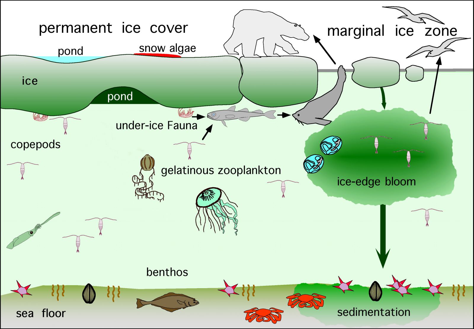
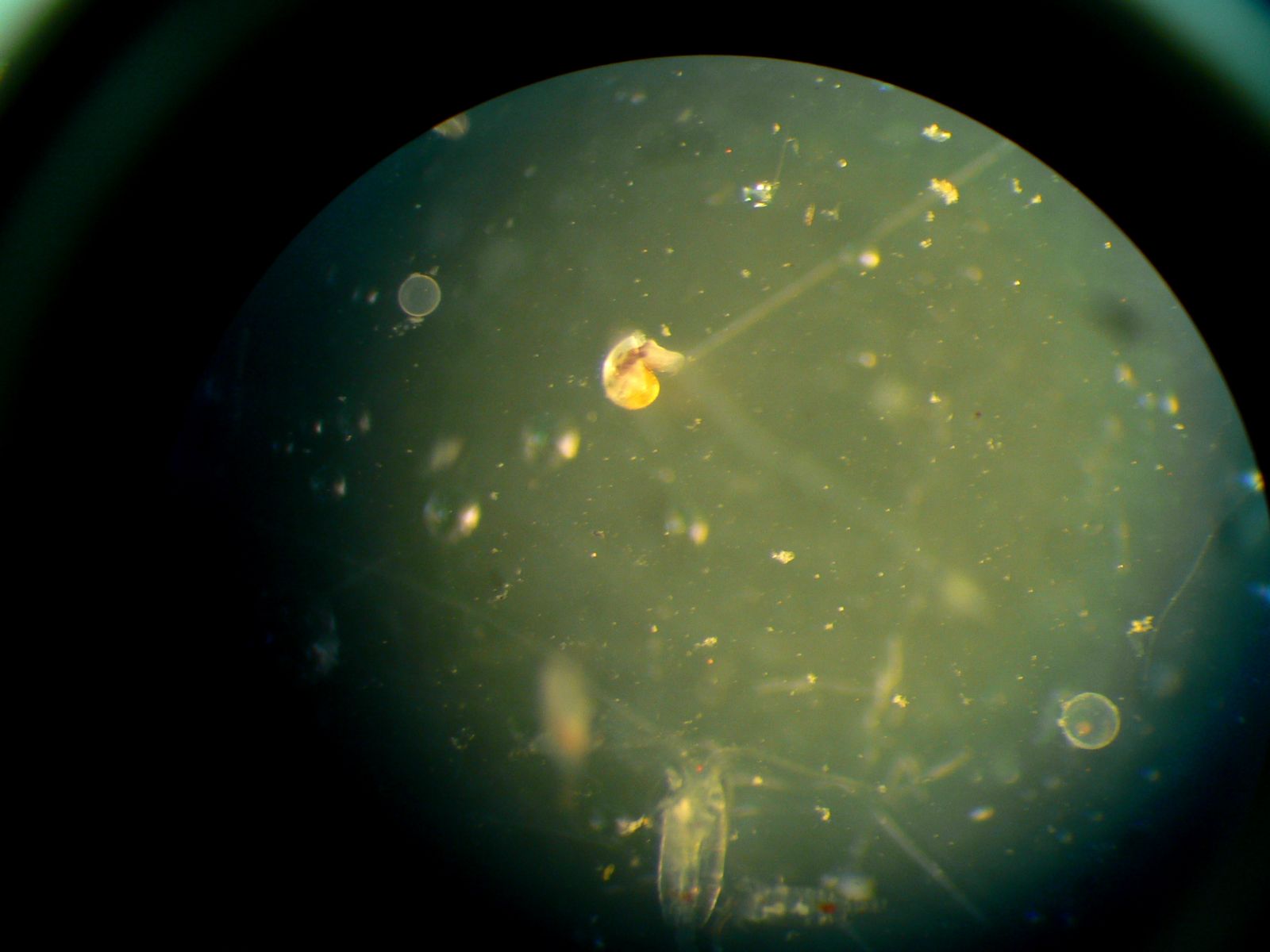
Sea ice fulfills fundamental functions in the seasonal rhythm of the northern Bering Sea. Algae grows on its surfaces and in channels within the ice. In the spring when the ice melts, these nutrients are released into the sea fueling a bloom of tiny marine plants (phytoplankton). The timing of the ice retreat and subsequent bloom influences how nutrients are distributed throughout the benthic (seafloor) and pelagic (water column) food web with major consequences for the northern Bering Sea ecosystem as a whole.10
In spring and summer, the northern Bering Sea reaps the benefits of the productivity left behind by the retreating ice. Migratory birds arrive, southern whales move in, and belugas follow schools of fish into coastal waters. Hunters and families return to their camps for the subsistence harvest and local commercial fisheries commence for herring, crab, halibut and salmon.
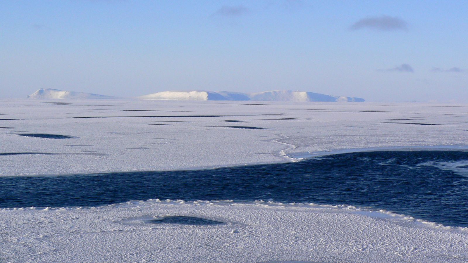
In the northern Bering Sea, ice usually comes in mid to late fall. First, shorefast ice forms along the coast. In the past, ice floes made of multi-year ice were observed coming down through the Bering Strait with the wind, but this no longer occurs because most multi-year ice has disappeared from the Chukchi Sea.11 As the water temperature of the Bering Sea drops, more ice forms until the winter ice pack covers the ocean. Shifting currents and wind drive the ice, creating open water leads and polynyas (persistent areas of open water maintained by currents, upwelling or prevailing winds). A persistent north wind will push the ice edge southward. Local conditions and ice movements are dynamic and powerful, making knowledge about them a fundamental skill for hunting. When the ice breaks up and goes out in the late spring, large numbers of seals, walruses and whales follow it north into the Chukchi Sea. In the fall, they return in front of the advancing ice edge and the cycle begins again.
Birds are flying after ugruk [bearded seal] hunting we put away herring roe and kelp… Couple weeks after ugruk hunting, right when grass is green and birds are flying over.12 Allan Sagoonick - Unalakleet
More about the Northern Bering Sea:
On marine mammals and sea ice
On ice dynamics
On respect for ice and currents
